Precision agriculture promises to put the right amount of water, fertilizer and crop protection in the right place at the right time. Much of the technology to do that is now affordable: low-power sensors, free satellite imagery and phones capable of running AI models offline. Yet many AgTech pilots stall after one season, not because the technology fails, but because it doesn’t fit how farms actually work.
This guide is for agribusinesses, cooperatives and AgTech founders deciding what to build. It covers the components that tend to deliver value, their real limitations, and how to run a pilot that produces a clear answer.
Soil moisture and weather sensors
In-field sensors give you ground truth that no satellite can: how much water is in the root zone right now, and how much rain actually fell on this field.
What to measure
- Soil moisture at more than one depth, so you can see whether water is reaching the roots or sitting near the surface
- Soil temperature, which affects germination and nutrient uptake
- Rainfall, air temperature and humidity from a local weather station, useful for irrigation and disease risk models
Connectivity options
Fields rarely have Wi-Fi, so connectivity is a core design choice:
- LoRaWAN offers long range and very low power, which suits battery-powered sensors that send small readings a few times an hour. You need a gateway within range, either your own or a community or commercial network.
- Cellular IoT (LTE-M or NB-IoT) avoids running gateways where carrier coverage exists, at the cost of a data plan per device and higher power use.
- Satellite IoT is an option for very remote sites, with tighter limits on message size and frequency.
Plan for maintenance
Sensors get hit by tractors, chewed by animals, buried in mud and drained of battery. Calibration drifts, and readings vary with soil type. Budget time for installation, removal before harvest and replacement. Build device health monitoring into the platform so a silent sensor is flagged, not mistaken for dry soil.
Satellite imagery and vegetation indices
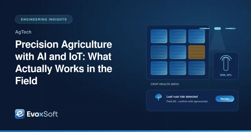
Satellite imagery shows variation across whole fields and whole regions. The ESA Copernicus Sentinel-2 mission provides free multispectral imagery at up to 10-meter resolution, with frequent revisits. From its red and near-infrared bands you can calculate vegetation indices such as NDVI (Normalized Difference Vegetation Index), a widely used proxy for plant vigor.
Used well, NDVI maps help you spot underperforming zones, compare fields and direct scouting to where it matters. Keep the limitations in view:
- Clouds block optical imagery. In wet seasons you may go weeks without a clear pass. Cloud masking is essential, and radar data such as Sentinel-1 can fill some gaps.
- NDVI saturates in dense canopies, so it’s less informative late in the season for some crops. Other indices can help.
- A low value tells you where, not why. Water stress, nutrient deficiency, disease and pests can look similar from orbit. Someone still has to walk the field.
Photo-based crop disease detection
A farmer photographs a leaf, and a model suggests likely diseases or pests. This is one of the most requested features, and one of the easiest to overpromise.
- Run models on the device. Compact models built with frameworks like TensorFlow Lite work without a connection and return results in the field. Sync photos later for server-side analysis and retraining.
- Expect accuracy to vary by crop, region and conditions. Models trained on clean lab images often perform worse on real photos with mixed lighting, soil in the background and multiple symptoms. Validate on images from your own growers before launch.
- Show confidence and alternatives. Present the top few possibilities with confidence levels, and let the user flag a result as wrong. Low-confidence results should route to an agronomist, not become a spray recommendation.
Irrigation scheduling
Irrigation advice combines soil moisture readings, weather forecasts, crop type and growth stage to suggest when and how much to water. Rule-based logic built with agronomists is often the right first version. It’s transparent, and it can be tuned per crop. Machine learning can refine it once you have seasons of data.
Keep recommendations practical. Farmers work within pump capacity, water rights, labor and power availability. Advice that ignores those constraints gets ignored.
Yield forecasting
Yield models combine satellite indices, weather, soil data and field history to estimate harvest volume. They help cooperatives and agribusinesses plan storage, logistics and sales. Forecasts improve as the season progresses and are least reliable early on. Present them as ranges rather than single numbers, and compare them against actual harvest data every season to track how well they hold up.
Offline-first mobile apps
Weak or absent coverage is the norm in many fields. An app that needs a connection will fail exactly where it’s used. Design offline-first:
- Store field boundaries, tasks, records and models on the device
- Queue photos and notes, and sync when a connection returns
- Resolve conflicts predictably when two people edit the same record
- Keep the interface simple, with large touch targets, local languages and minimal typing
Why agronomist review matters
AI recommendations in agriculture have real costs when they’re wrong: a missed disease outbreak, an unnecessary spray, an over-watered field. Put an agronomist review step between models and high-stakes advice, especially early on. Their corrections double as labeled data that improves the models, and their involvement earns farmer trust in a way a model can’t.
Data ownership and farmer trust
Farmers are right to ask who owns their data and how it will be used. Be clear, in plain language:
- Farmers own their farm data, and can export or delete it
- Data is not shared with third parties, such as input suppliers or buyers, without explicit consent
- Cooperative or agribusiness access is defined and visible to the farmer
- Aggregated or anonymized data use is explained up front
Multi-tenant architecture should enforce this separation technically, not only in the terms of service.
How to pilot across a growing season
A pilot should answer a specific question, and farming gives you one chance per season to answer it.
- Pick one or two problems worth solving, such as early disease detection in one crop or irrigation timing.
- Choose a small, varied group of farms with growers willing to give honest feedback.
- Install sensors and set baselines before planting, not mid-season.
- Define success up front, for example agronomist agreement with disease suggestions or farmer adoption of irrigation advice.
- Hold regular check-ins through the season, and fix usability issues quickly.
- Review results after harvest against your success criteria and decide what to scale, change or drop.
Our AI-powered farm management app blueprint shows how these components come together in one platform. For the sensor and device side, the IoT fleet tracking platform blueprint covers the same ingestion, device management and alerting patterns.
Start with a focused pilot
Precision agriculture works when it respects the realities of the field: patchy connectivity, variable data and farmers who need advice they can trust. Our web and mobile app development team builds offline-first field apps, and our cloud services team designs the data platforms behind them. If you’re planning an AgTech product or a first-season pilot, get in touch.